
Cherrapunji (Sohra)
Updated 2026Where the Monsoon Cascades Over Ancient Limestone Gorges
| Category | Detail |
|---|---|
| Altitude / Elevation | 1,430 meters (4,690 ft) |
| Annual Rainfall | 11,777 mm (Wettest place on Earth) |
| Coordinates | 25.27° N, 91.73° E |
| District | East Khasi Hills, Meghalaya |
| Driving From Guwahati | 150 km (4.5 hours via NH6) |
| Primary Language | Khasi, English |
Cherrapunji (locally known as Sohra) is a high-altitude subdivisional town situated in the East Khasi Hills district of Meghalaya at an altitude of 1,430 meters above sea level. Located 54 km south of Shillong and 148 km from Guwahati, it is globally renowned for its extraordinary monsoon rainfall, dramatic sandstone canyons, plunging waterfalls, and living root bridges.
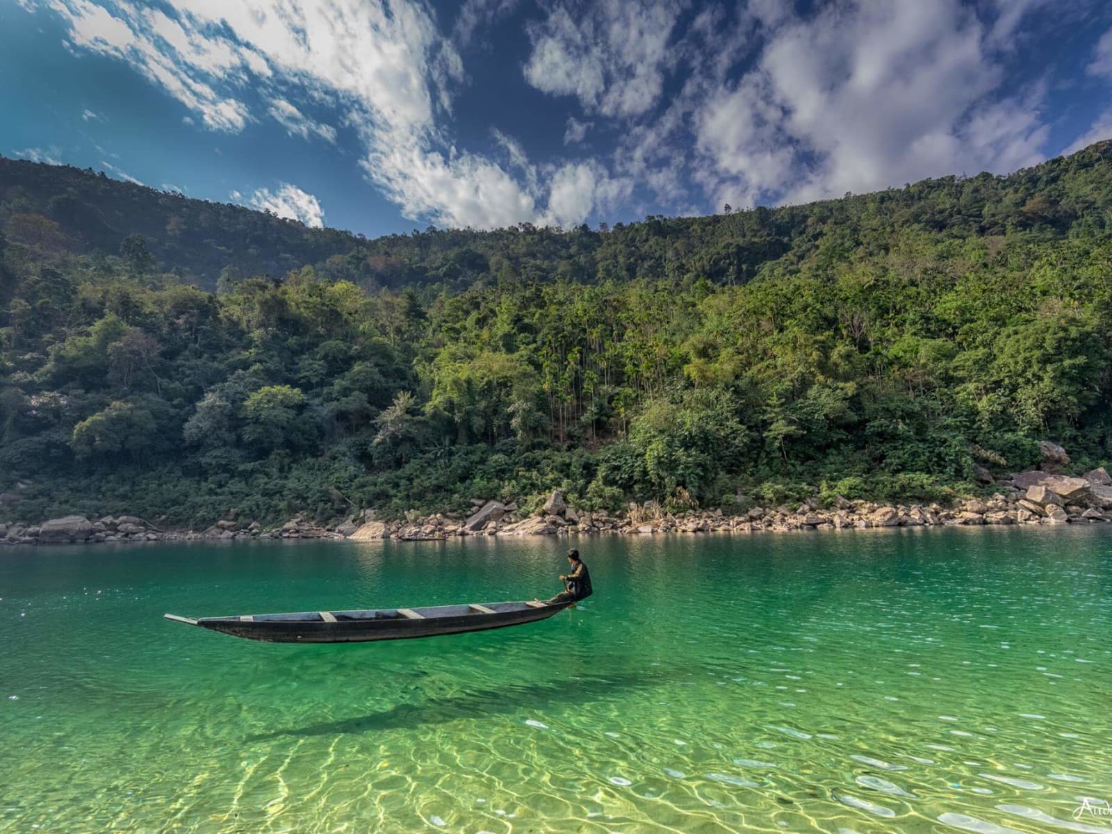
The crisp highland air carries the damp scent of rainforest moss and wet sandstone ledges. Thick white cloud mist rolls across steep gorge precipices, echoing with the roar of Nohkalikai and Nohsngithiang waterfalls cascading into emerald plunge pools below.
No Inner Line Permit (ILP) required. Eco-tourism village entry fees (₹20–₹50) apply at Nohkalikai, Mawsmai Cave, and Wei Sawdong.
Geography, Topography & Canyon Geology
Perched at an altitude of 1,430 meters (4,692 feet) above sea level in the East Khasi Hills of Meghalaya, Cherrapunji—known locally by its historical Khasi name Sohra—occupies a high-altitude sandstone tableland resting on the southern escarpment of the Meghalayan plateau. Geologically, this plateau is composed primarily of massive, horizontally bedded Cretaceous-Tertiary Khasi Group sandstones and dense marine limestone strata resting atop a Precambrian basement complex. Over millions of years, relentless tectonic uplift combined with unyielding precipitation has carved dramatic topography characterized by flat-topped tablelands, sheer vertical precipices, and deeply incised river gorges.
The southern border of the Sohra plateau drops abruptly into the vast low-lying alluvial floodplains of Sylhet in Bangladesh. This sharp 1,400-meter vertical drop creates one of the world's most dramatic topographic declivities. Ravines such as the Mawkdok Dympep Valley and the grand Sohra Canyon bisect the plateau, featuring vertical sandstone walls that plunge hundreds of meters down into dense subtropical rainforest basins. Soluble limestone beds beneath the sandstone surface have undergone extensive dissolution, spawning subterranean karst networks containing intricate cavern systems, underground rivers, and fossiliferous rock formations.
Meteorological Records & Heavy Rainfall Phenomenon
Cherrapunji is internationally famous for its extreme hydrologic profile, holding historical Guinness World Records for the highest recorded annual rainfall in a single calendar year (22,987 millimeters between August 1860 and July 1861) and the highest rainfall in a single month (9,300 millimeters in July 1861). Today, Sohra receives an extraordinary average annual rainfall of approximately 11,777 millimeters, competing closely with neighboring Mawsynram for the title of the wettest place on Earth.
This meteorological phenomenon is driven by the Bay of Bengal branch of the South Asian Summer Monsoon. From June through September, moisture-laden air masses sweep northward across the warm, flat plains of Bangladesh without encountering any physical barriers. When these humid winds collide with the vertical wall of the Khasi Hills escarpment, they are forced into rapid upward elevation—a process known as intense orographic lift. As the rising air cools at higher altitudes, moisture condenses rapidly, releasing torrential cloudbursts over the Sohra tableland. During peak monsoon, over 100 temporary waterfalls burst into existence across the cliff faces, and dense white sea clouds (ka lyoh) sweep over the plateau ridges, enveloping the landscape in atmospheric mist.
Nongriat Double Decker Living Root Bridge & Valley Trekking Logistics
Deep within the subtropical jungle basin beneath the Sohra plateau lies the remote Khasi hamlet of Nongriat, home to one of humanity's most extraordinary feats of living bio-engineering: the Umshiang Double Decker Living Root Bridge (Jingkieng Jri). Centuries ago, Khasi indigenous ancestors devised a technique to cross swollen monsoon rivers by guiding the flexible aerial roots of the Ficus elastica (Indian rubber fig tree) through hollowed betel nut trunks placed across river channels. Over decades, these living roots crossed the river, anchored into the opposing bank soil, and naturally self-grafting into sturdy pedestrian walkways. The Nongriat structure features two stacked tiers of living root bridges spanning 25 meters across the turquoise Umshiang River, growing stronger with every passing year.
Reaching Nongriat requires descending a grueling stone staircase of approximately 3,500 steep steps starting from Tyrna village (12 km from Sohra town). The trail plunges into a dense jungle valley, crossing two narrow steel wire suspension bridges that sway over roaring emerald river rapids.
Trekking Logistics & Pacing Guide
- Start Location & Parking: Tyrna Village base point (Vehicle parking fee: ₹50).
- Step Count & Distance: ~3,500 steps down (and 3,500 steps back up), covering 3 km each way with an elevation drop of over 600 meters.
- Trek Duration: 2 to 2.5 hours for the descent; 2.5 to 3.5 hours for the return climb.
- Overnight Stay vs. Day Trip: While fit trekkers can complete the round trip in a single day (5–6 hours total), spending a night at a local Nongriat homestay is highly recommended. This allows travelers to trek another 1.5 hours further up the valley to witness the stunning Rainbow Falls, where water plunges over white granite boulders into an electric-blue plunge pool.
- Physical Fitness: High stamina required. Trekkers should wear proper trail shoes with aggressive rubber grip, carry bamboo walking sticks (available for ₹20 at Tyrna), and pace their breathing during the arduous climb back up.
Subterranean World: Arwah & Mawsmai Limestone Caves
The dissolution of Sohra's thick limestone strata by carbon-acidified rainwater has created an expansive underworld of natural karst caves, offering travelers accessible windows into deep geological history.
Mawsmai Cave
Located 6 km from Sohra town near Mawsmai village, Mawsmai Cave is the most accessible cave system in Meghalaya. The cave is fully illuminated with low-voltage lighting and outfitted with wooden safety walkways. Visitors navigate a 150-meter natural limestone corridor featuring towering stalactites, stalagmites, and rock pillars carved by ancient streams. Certain sections require crouching through narrow rock squeezes and stepping over shallow natural pools, providing an exciting yet safe spelunking experience suitable for families.
Arwah Cave
Situated near Sohra town amidst a scenic cliffside nature park, Arwah Cave is larger, wilder, and less commercialized than Mawsmai. Approached via a scenic 800-meter wooden boardwalk hugging steep limestone cliffs covered in ferns, the cave features wide, soaring chambers and active underground streams. Arwah is globally celebrated for its abundance of marine fossils embedded directly into the limestone walls. Sharp-eyed visitors can spot 50-million-year-old preserved shells, gastropods, and crustacean fossils exposed in the rock ceiling, dating back to the Eocene epoch when Northeast India lay beneath the ancient Tethys Ocean.
Iconic Cascades & Waterfall Circuits
Sohra's dramatic tableland cliffs and massive rainfall create some of the highest and most spectacular waterfalls in Asia.
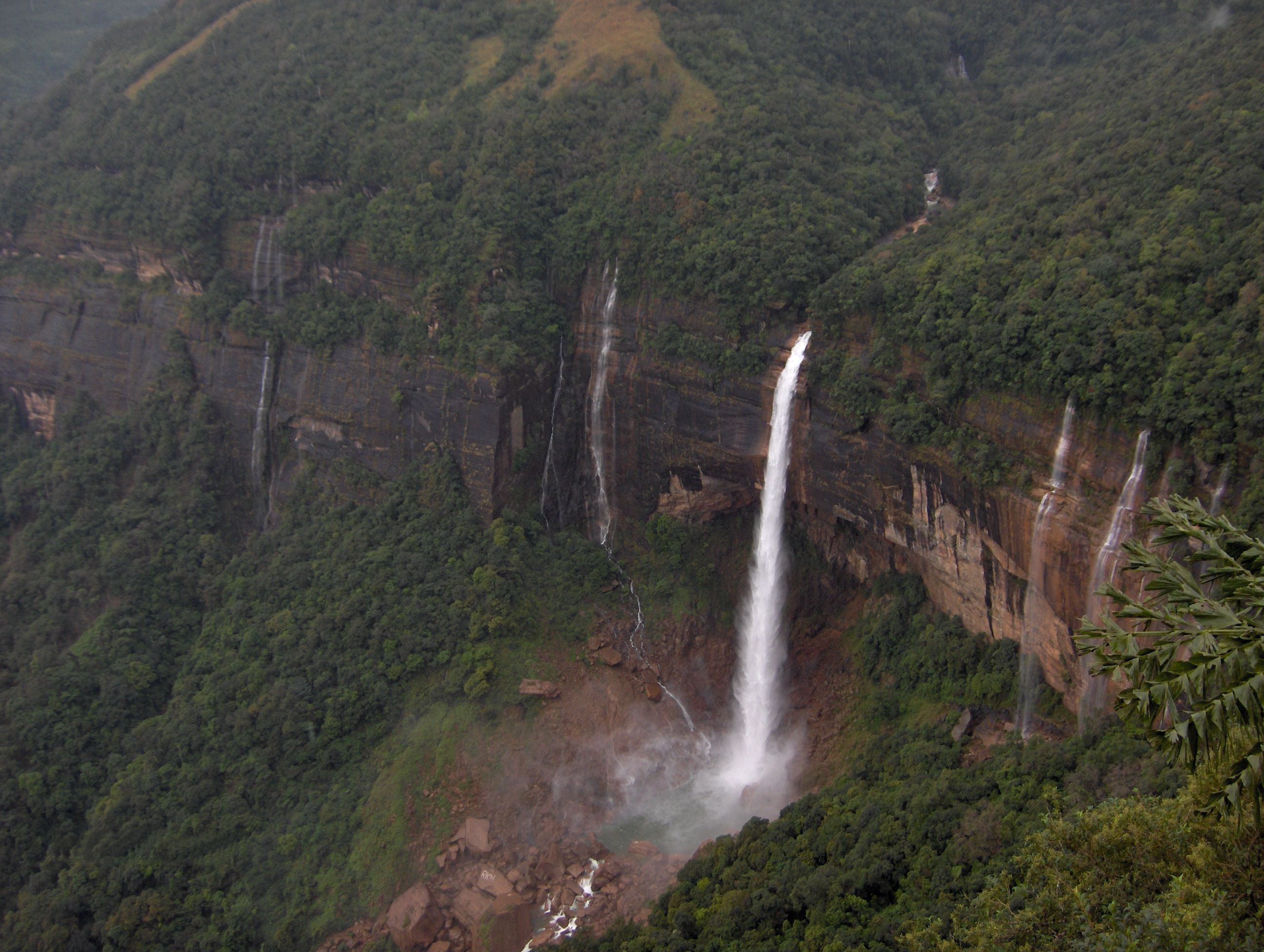
- Nohkalikai Falls: Plunging 340 meters (1,115 feet) down a sheer reddish-brown sandstone cliff into an intense turquoise plunge pool, Nohkalikai is India's highest plunge waterfall. The waterfall is steeped in tragic Khasi folklore about a grieving mother named Likai (Noh-ka-Likai translates to "Jump of Likai"). Viewing platforms along the cliff edge offer panoramic vistas, especially in early morning before valley fog rolls in.
- Seven Sisters Falls (Nohsngithiang Falls): Located near Mawsmai village, this massive 315-meter waterfall features seven distinct water streams cascading side-by-side down limestone cliffs during the monsoon, symbolizing the seven sister states of Northeast India. The falls face east, making late afternoon sunlight ideal for photography.
- Wei Sawdong Waterfall: A hidden three-tiered stepped cascade tucked inside a deep forested ravine. Water tumbles down three broad emerald pools stacked above one another. Access involves a steep 20-minute descent down rustic bamboo staircases and dirt trails.
- Kynrem Falls: A majestic three-tiered cascade dropping 305 meters inside Thangkharang Park, visible from the winding highway down to Shella.
- Dainthlen Falls: A wide, roaring bedrock waterfall where the Sohra river surges across smooth sandstone ledges carved with natural pothole formations, linked to the Khasi legend of the slaying of a giant serpent (Thlen).
Khasi Cultural Heritage & Local Food Culture
Sohra is the cultural heartland of the indigenous Khasi people, an Austroasiatic ethnic group with a rich matrilineal social structure. In Khasi society, family lineage, clan surnames, and ancestral property pass through the female line, with the youngest daughter (Khaddu) serving as the custodian of the ancestral home. Local governance is maintained through the Dorbar Shnong (village traditional council), which enforces community sanitation, land conservation, and civic welfare.
Highland Khasi Culinary Specialties
Khasi cuisine in Sohra reflects the cool highland climate, relying on organic hill rice, smoked meats, wild herbs, and fermented pastes:
- Jadoh: The quintessential Khasi comfort dish made of short-grain red hill rice cooked with pork or chicken stock, finely chopped ginger, garlic, and local spices.
- Dohneiiong: Tender chunks of pork braised in a thick, fragrant gravy made from roasted black sesame seeds (nei-iong), ginger, and green chilies.
- Tungrymbai: A pungent, savory dish of fermented soybeans sautéd with pork fat, ginger, garlic, and chili paste, eaten with steaming hot red rice.
- Sohra Oranges & Orange Blossom Honey: Sohra's sweet, thin-skinned mandarins (Soh Niamtra) are famous throughout Northeast India, harvested from orchards along southern escarpment slopes from November through January. Local beekeepers produce amber wild orange blossom honey.
- Kwai (Betel Nut & Leaf): A universal symbol of Khasi hospitality, consisting of raw betel nut (kwai), betel leaf (patia), and slaked lime (shun), offered to every guest upon entering a house.
Practical Travel Guidance (The Honest Guide)
To ensure a seamless journey across Cherrapunji, travelers should keep these grounded, practical realities in mind:
Staircase Trekking & Knee Strain
The 3,500-step descent and ascent to Nongriat taxes knee joints and calf muscles severely. Travelers with pre-existing knee issues, cardiac conditions, or low fitness should consider hiring local porters at Tyrna, using bamboo trekking poles for weight distribution, and taking frequent hydration breaks. Do not attempt the return ascent in the blazing mid-day sun without adequate water and electrolyte packets.
Monsoon Landslides & Zero-Visibility Fog
During peak monsoon months (June to September), Sohra experiences heavy cloudbursts that can trigger localized rockfalls along State Highway 11. Thick, white mountain fog (lyoh) can roll over Nohkalikai and Seven Sisters viewpoints within minutes, reducing visibility to zero. Plan viewpoint visits early in the morning (between 7:30 AM and 10:30 AM) when skies are clearest, and ensure private drivers are experienced with mountain fog lamps.
Cash Reliance & Intermittent Cellular Networks
While 4G data (Jio and Airtel) works reliably in main Sohra Bazaar and major resort properties, cellular signals drop completely inside deep river gorges, caves, and along the Nongriat trek. Digital UPI payments (Google Pay, PhonePe) and credit cards frequently fail at local waterfall entry kiosks, village tea stalls, and homestays. ATMs in Sohra town center frequently run dry during weekend rushes. Always carry a minimum of ₹3,000 to ₹5,000 in physical cash for site entry fees, guide charges, and local meals.
Respecting Eco-Decorum & Local Traditions
Sohra's natural sites and living root bridges are sacred community assets preserved by local villages. Do not carve names into living root trees, refrain from littering single-use plastics along valley trails, avoid loud speakers in quiet hamlets, and always seek permission before photographing Khasi elders or private family homes.
Cherrapunji held the world record for highest annual rainfall — 26,471 mm between August 1860 and July 1861.
TRAVEL PLANNING
Plan Your Visit
Essential guides to prepare for your trip
Itineraries & Trips
Curated 3-day, 5-day & 7-day trip routes
Places to Visit
Top waterfalls, viewpoints & landmarks
Best Time to Visit
When to go for the best experience
How to Reach
Flights, trains, taxis and road options
Where to Stay
Homestays, eco-lodges & resorts
Festivals & Events
Cultural celebrations & seasonal events
Cherrapunji Tour Packages
Ready-to-book Cherrapunji tours
Need a Custom Plan?
As Northeast India locals, we work directly with our trusted community drivers and homestay hosts.
Talk to an ExpertTOP ATTRACTIONS
Places to Visit in Cherrapunji
Must-see attractions and hidden gems across Cherrapunji


- Mawkdok Dympep Valley: The dramatic gateway gorge and viewpoint to Cherrapunji in Meghalaya.
- Wah Kaba Falls: A seasonal cascade plunging into a deep subtropical gorge.
- Arwah Cave: An Eocene limestone cave housing ancient marine fossils.
- Nohkalikai Falls: India's tallest plunge waterfall, framed by a tragic legend.
- Seven Sisters Falls: India's iconic seven-segmented cascade plunging over the Sohra escarpment.
- Mawsmai Nongthymmai Eco Park: A cliff-edge botanical park hosting the headwaters of Seven Sisters Falls.
- Kynrem Falls: A dramatic three-tiered cascade passing beneath a valley highway.
- Garden of Caves: A maze of hidden cascades, heart-shaped rock sculptures, and historic Khasi shelter caves.
- Wei Sawdong Falls: A three-tiered turquoise cascade hidden in a forested ravine.
- Double Decker Living Root Bridge: A two-tiered botanical masterpiece grown over centuries by indigenous Khasi hands.
- Eco Park: Panoramic Valley Views
- Double Decker Living Root Bridge: Bio-engineering Marvel
How Many Days in Cherrapunji?
Plan your own route — or let us handle everything
Things to Do in Cherrapunji
Curated experiences and activities across Cherrapunji by local experts
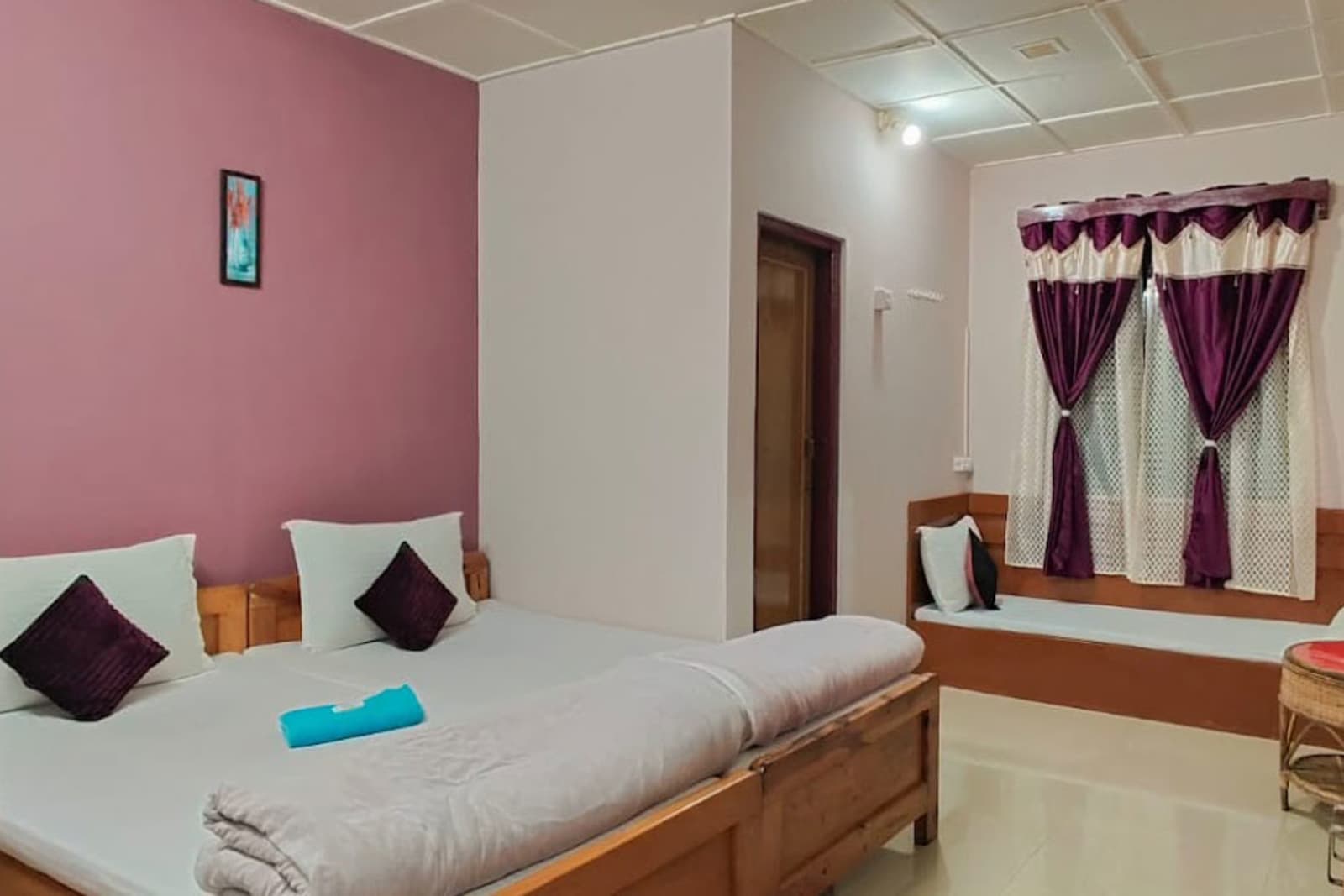
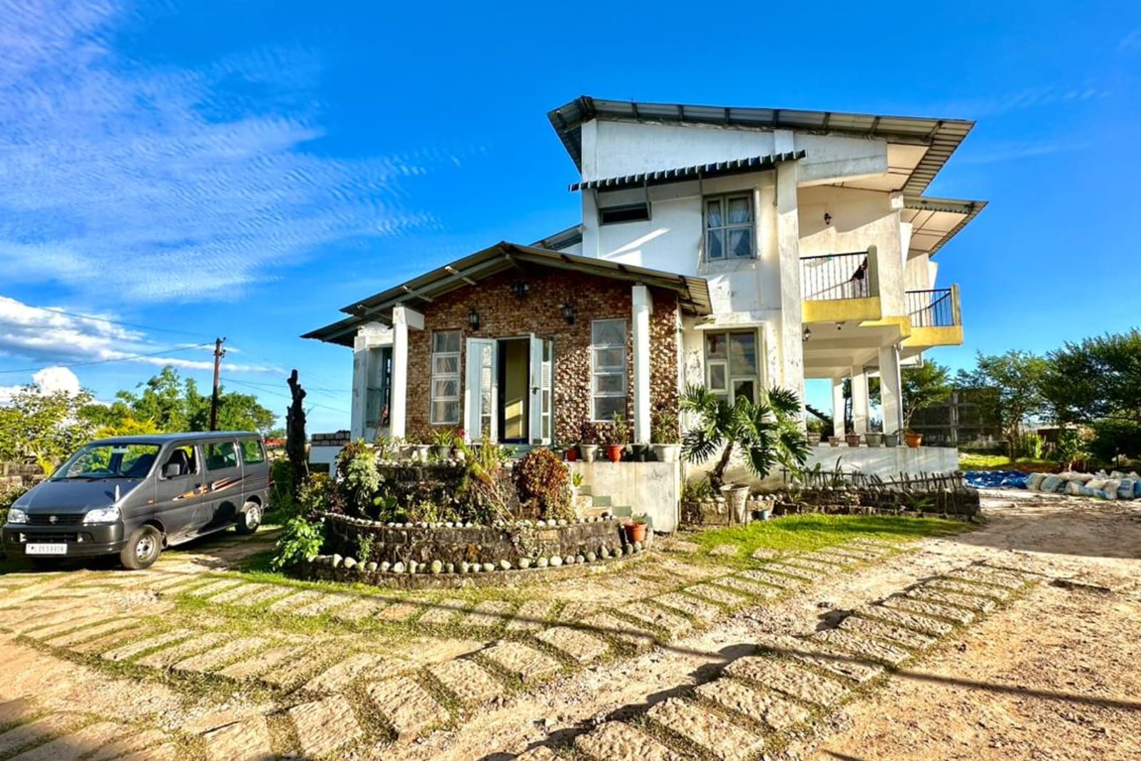
Where to Stay in Cherrapunji
Verified stays in Cherrapunji with local character



Getting Around
Safe, reliable transfers and car hire in Cherrapunji
Practical Travel Realities & Local Tips
Terrain, ground rules, and essential preparation for Cherrapunji
Terrain & Fitness Requirements
While most waterfall viewpoints and caves involve minimal walking, reaching Nongriat root bridges requires moderate to high physical stamina.
Paved walkways, viewing platforms, and short flight of steps. Accessible to all age groups.
Uneven limestone rock floors, damp slippery surfaces, and short narrow squeezes in Mawsmai Cave. Requires sturdy shoes.
Steep downward trek via rustic bamboo ladders and dirt trails. Can be muddy and slippery in monsoon.
Descent and ascent of approximately 3,500 stone steps down Tyrna village valley, crossing suspension bridges over rushing mountain rivers. 4–6 hours total trek time.
Local Culinary Traditions & Food
Authentic indigenous gastronomy, tribal flavours, and culinary culture in Cherrapunji
Khasi Cuisine & Local Food Specialties
Khasi food culture in Sohra relies on organic local produce, smoked meats, wild herbs, and fermented soybean pastes.
Jadoh
The signature Khasi staple made of short-grain red rice cooked with minced pork or chicken broth, ginger, and local spices.
Dohneiiong
Tender pork cooked in a rich, nutty gravy made from roasted black sesame seeds (neiiong) and local herbs.
Tungrymbai
A comforting dish prepared from fermented soybeans sauteed with pork fat, garlic, ginger, and chili paste.
Sohra Oranges & Kwai
Famed sweet Cherrapunji oranges harvested in autumn, alongside Kwai (traditional betel nut and leaf) offered as a gesture of Khasi hospitality.
Combine Cherrapunji With
Extend your trip with nearby destinations
Travel Guides
Expert guides for Cherrapunji
Reviews
"Nohkalikai Falls is the most spectacular waterfall I've ever seen. Nezo arranged a guide for the Double Decker Root Bridge trek — a must-do."
Tom Baker
London, UK
"Cherrapunji in winter was surprisingly sunny. Nezo's driver was excellent, taking us to all viewpoints. The orange honey is delicious."
Neha Gupta
Pune, Maharashtra
"The living root bridges are an engineering marvel. Nezo arranged a Khasi guide who explained how the roots are trained over decades."
Carlos Mendez
Barcelona, Spain
PLAN YOUR TRIP
FAQs
Can't find the answer you're looking for? Our expert travel team is always on hand to help you plan the perfect Cherrapunji experience.
Ready to Explore Cherrapunji?
Let our local experts help you plan the perfect trip. Get personalized recommendations and instant quotes.