
Meghalaya (The Abode of Clouds)
Updated 2026The Abode of Clouds, Ancient Living Root Bridges & Matrilineal Hill Sanctuaries
11,777 mm
Avg Annual Rainfall
3 Major
Tribes (Khasi, Jaintia, Garo)
340 m
Nohkalikai Falls
1+
Curated Trips
| Category | Detail |
|---|---|
| Altitude / Elevation | 60 m (Bangladesh Border / Shella Lowlands) to 1,961 m (Shillong Peak) |
| Best Time to Visit | October to May (Clear skies, trekking, and transparent river waters; Monsoon Jun–Sep for roaring waterfalls) |
| Capital | Shillong (East Khasi Hills, 1,525 m altitude) |
| Iconic Waterfalls | Nohkalikai Falls (340 m plunge), Nohsngithiang (Seven Sisters), Wei Sawdong (3-tier), Krang Shuri, Kynrem Falls (305 m) |
| Living Bio Engineering | Over 100 Living Root Bridges (Jingkieng Jri) bio-engineered from Ficus elastica roots; Double Decker Bridge in Nongriat |
| Permit Requirement | No Inner Line Permit (ILP) required — completely open and permit-free for domestic and foreign travelers |
| Rainfall Records | Mawsynram (11,872 mm) & Cherrapunji / Sohra (11,777 mm) — Wettest places on Earth |
| Social System | Matrilineal descent (Lineage & ancestral property pass through the youngest daughter, Ka Khadduh) |
| Subterranean Caves | 1,700+ mapped limestone/sandstone caves (Krem Liat Prah: 34 km long; Krem Mawmluh: Geological Meghalayan Age) |
| Three Indigenous Tribes | Khasi (Hynniewtrep), Jaintia (Pnar/Synteng), Garo (A'chik) |
| Total Area | 22,429 sq km |
Meghalaya is a world-renowned highland plateau state in Northeast India, spanning 22,429 square kilometers across the Khasi, Jaintia, and Garo Hills. Celebrated globally as 'The Abode of Clouds' and the undisputed precipitation epicenter of the planet—housing Cherrapunji (Sohra) and Mawsynram (averaging nearly 12,000 mm of annual rainfall)—the state is famous for its bio-engineered Living Root Bridges (Jingkieng Jri), the crystal-clear glass waters of the Umngot River at Dawki, extensive subterranean limestone cave systems like Krem Liat Prah, ancient sacred groves (Law Kyntang), and its progressive matrilineal tribal heritage.
The damp, refreshing mountain air smells of crushed pine needles, wild rainforest moss, and mineral-rich sandstone as heavy clouds roll across the edge of the Cherrapunji plateau. Far below in the deep green canyons, the continuous, thunderous roar of Nohkalikai and Seven Sisters waterfalls echoes against vertical cliffs, while beneath the dense jungle canopy, the woven living aerial roots of ancient rubber fig trees form sturdy, breathing bridges across turquoise mountain torrents.
Travel to Meghalaya is completely open, unrestricted, and permit-free. Domestic Indian citizens do NOT require an Inner Line Permit (ILP) or any special pass to enter or travel within Meghalaya. Foreign travelers require only a standard valid Indian Visa / e-Visa and Passport; no Protected Area Permit (PAP) or Restricted Area Permit (RAP) is required. All tourists (Indian and foreign) are encouraged to complete free digital registration on the Meghalaya Tourism App (meghalayatourism.in) to generate an E-Invite QR code for smooth check-ins at hotels and tourist kiosks.
The Elevated Geological Plateau: Khasi, Jaintia & Garo Escarpments (22,429 sq km)
Meghalaya, poetically translating from Sanskrit as 'The Abode of Clouds', is a distinct highland plateau state spanning 22,429 square kilometers in Northeast India. Located between coordinates 25.57° N, 91.88° E, the state is a massive, uplifted Precambrian crystalline block bounded by the alluvial plains of the Brahmaputra Valley of Assam to the north and the low-lying river deltas of Bangladesh to the south. The elevation ranges from 60 meters along the southern Bangladesh border at Shella and Dawki to 1,961 meters (6,434 feet) at Shillong Peak in the East Khasi Hills.
Geographically, the state is divided into three prominent highland regions:
- The Khasi Hills (Central): The elevated heartland comprising East Khasi Hills, West Khasi Hills, South West Khasi Hills, and Eastern West Khasi Hills, featuring sweeping rolling meadows, deep sandstone canyon gorges, pine-scented valleys, and the capital city of Shillong (1,525 m).
- The Jaintia Hills (East): Comprising West and East Jaintia Hills, characterized by rich mineral plateaus, sacred ancient megalithic sites at Nartiang, and the turquoise river basins of Krang Shuri and Phe Phe Falls.
- The Garo Hills (West): Comprising West, East, South, North, and South West Garo Hills, characterized by dense tropical evergreen rainforests, rich biodiversity sanctuaries, and the subterranean river caves of the Simsang basin.
The climate of Meghalaya is globally unique. Facing the direct brunt of moisture-laden summer monsoon winds sweeping northward from the Bay of Bengal across the flat Bangladesh plains, the southern escarpment of the Khasi Hills forces the air to rise rapidly (orographic uplift), resulting in colossal cloud condensation and the highest recorded rainfall on Earth.
The Global Precipitation Epicenter: Cherrapunji (Sohra) & Mawsynram Plunge Waterfalls
Perched on the southern edge of the plateau overlooking the Bangladesh plains, the neighboring highland settlements of Cherrapunji (Sohra) and Mawsynram hold the undisputed Guinness World Records for annual precipitation:
- Mawsynram: The wettest place on Earth, receiving an extraordinary average annual rainfall of 11,872 millimeters.
- Cherrapunji (Sohra): Averaging 11,777 millimeters annually, Sohra holds historical global records for the most rainfall in a single calendar year (26,471 mm) and in a single calendar month (9,300 mm).
This torrential precipitation has carved the southern edge of the plateau into sheer vertical canyon walls exceeding 1,000 meters in depth, creating India’s most spectacular collection of plunge and tiered waterfalls:
- Nohkalikai Falls (340 m / 1,115 ft): The tallest plunge waterfall in India, where a massive column of water leaps freely from the plateau edge into a deep, supernatural turquoise-green plunge pool below.
- Nohsngithiang Falls (Seven Sisters Falls, 315 m): A breathtaking seven-segmented waterfall cascading down high limestone cliffs side by side, symbolizing the seven sister states of Northeast India.
- Wei Sawdong Falls: A pristine, emerald-green three-tiered natural cascade hidden within dense subtropical rainforest, accessible via hand-made bamboo ladders.
- Kynrem Falls (305 m): A magnificent three-tiered waterfall plunging down forested precipices within Thangkharang Park.
Living Bio-Engineering: The Sacred Living Root Bridges (Jingkieng Jri) of Nongriat
Meghalaya’s most profound contribution to world architecture and indigenous sustainability is the living bio-engineering of Living Root Bridges (Jingkieng Jri). Developed centuries ago by the indigenous Khasi and Jaintia peoples to cross raging monsoon mountain torrents where timber structures would quickly rot, these functional pedestrian bridges are created not by cutting wood, but by growing live trees.
The Bio-Engineering Process
Villagers guide the flexible, aerial secondary roots of the Indian Rubber Fig tree (Ficus elastica) across river gorges using hollowed-out betel nut (Areca catechu) tree trunks as scaffolding. Over 15 to 30 years, the aerial roots cross the span, anchor firmly into the opposite riverbank soil, and undergo natural inosculation (self-grafting), fusing together into a living, structural network. Stones, timber planks, and soil are placed on the root deck. Unlike steel or concrete bridges that deteriorate over time, a Living Root Bridge is a self-renewing organism that grows stronger with age, with mature bridges capable of supporting the weight of 50 people simultaneously and surviving for over 500 to 600 years.
The pinnacle of this living architecture is the world-famous Double Decker Living Root Bridge (Umshiang Bridge) in the remote canyon village of Nongriat. Reached via a strenuous descent of 3,540 hand-laid concrete steps from Tyrna village, this two-tiered root bridge spans the roaring Umshiang River. A short trek beyond leads to the crystalline natural lagoon of Rainbow Falls. In 2022, Meghalaya's network of over 100 Living Root Bridges was inscribed on UNESCO’s tentative list of World Heritage Sites.
Matrilineal Social Structure & Sacred Groves: The Khasi Ka Khadduh & Mawphlang Forest
Meghalaya is home to one of the world's largest surviving matrilineal societies, practiced by the Khasi (Hynniewtrep), Jaintia (Pnar), and Garo (A'chik) peoples:
- Matrilineal Kinship & Heritage: Lineage, family surname, and ancestral property pass down from mother to daughter. The youngest daughter—known in Khasi as Ka Khadduh—is the custodian of the ancestral home (Iing Khadduh), responsible for caring for aging parents and conducting family ceremonies. Husbands move into their wife's family home upon marriage, and children take their mother's clan name.
- Shad Suk Mynsiem & Wangala Festivals: The cultural calendar features joyful thanksgiving celebrations: the Khasi Shad Suk Mynsiem (Dance of Peaceful Hearts) held in April, the Jaintia Behdienkhlam festival in July, and the Garo 100 Drums Wangala Festival in November, where hundred-drum ensembles honor the sun god Saljong.
- Sacred Groves (Law Kyntang): The indigenous tribes have protected primary virgin forests for centuries through strict customary taboos. The most famous is the Mawphlang Sacred Forest, a 192-acre ancient botanical sanctuary where ancient coronation monoliths, medicinal mosses, carnivorous pitcher plants (Nepenthes khasiana), and centuries-old oak canopies are preserved. Custom strictly dictates that nothing may be removed from the sacred grove—not a leaf, pebble, or flower—preserving pristine biodiversity.
Crystalline Hydrology: The Umngot River of Dawki & Krang Shuri Turquoise Lagoons
The crystalline river networks of Meghalaya provide world-class freshwater aquatic landscapes:
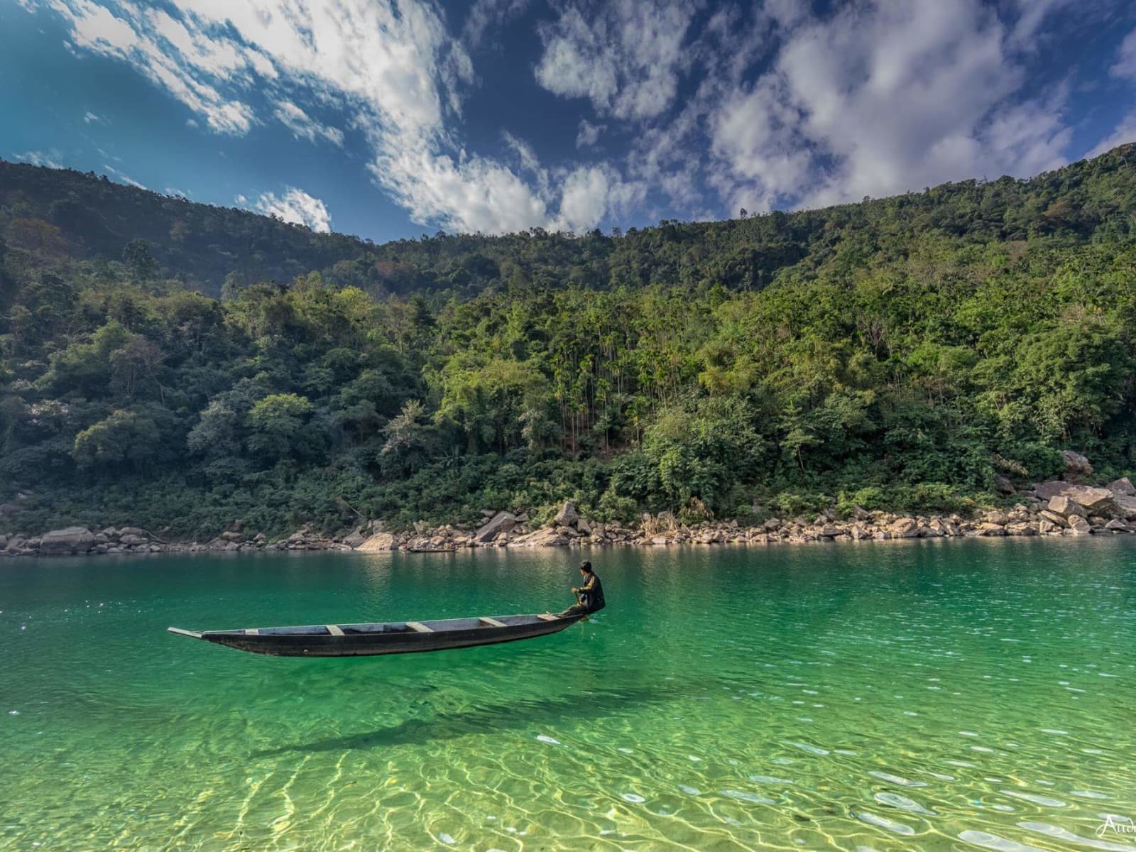
- The Umngot River at Dawki & Shnongpdeng: Located along the southern border 85 km from Shillong, the Umngot River is world-renowned for its astonishing water clarity from November to April. The water is so transparent that traditional wooden country boats appear to be floating on clear air above the pebbled riverbed. Travelers engage in riverside glamping, kayaking, snorkeling, and scuba diving in Shnongpdeng.
- Krang Shuri Falls (West Jaintia Hills): Located near Amlarem, Krang Shuri is celebrated for its natural, shimmering turquoise-cyan lagoon fed by a broad curtain waterfall flowing over a smooth limestone ledge.
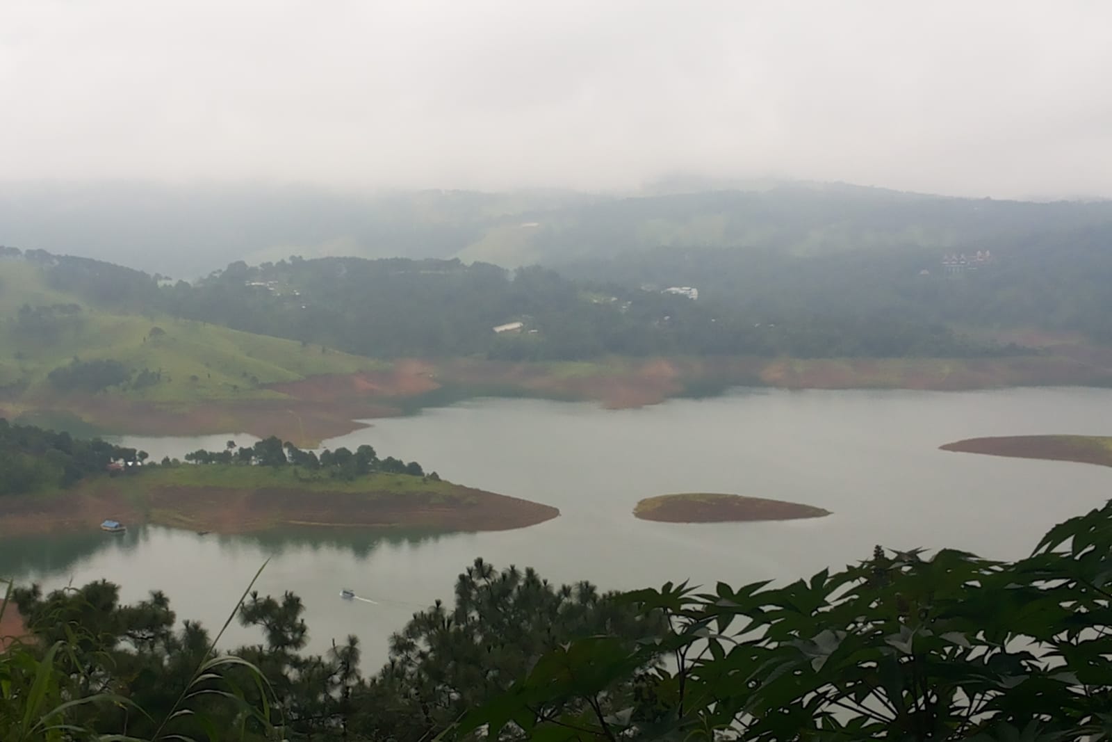
- Umiam Lake (Barapani): Located 15 km north of Shillong along NH6, this vast, picturesque freshwater reservoir spans 220 square kilometers, surrounded by dense pine forests and offering water sports, speed boating, and luxury lakeside retreats.
Subterranean Karst Caves: Krem Liat Prah, Arwah & The Geological 'Meghalayan Age'
Due to its extensive limestone and sandstone geological strata eroded by high rainfall, Meghalaya possesses the most extensive cave systems in South Asia, with over 1,700 explored caves spanning more than 530 kilometers of underground passages:
- Krem Liat Prah (East Jaintia Hills): The longest natural cave in South Asia, mapped to a continuous length of over 34 kilometers, featuring colossal underground river galleries, cathedral chambers, and pristine stalactites.
- Krem Mawmluh & The 'Meghalayan Age': In 2018, the International Commission on Stratigraphy (ICS) officially designated the current geological age of Earth's history as the 'Meghalayan Age' (spanning the last 4,200 years). This global scientific milestone was established based on stalagmite oxygen isotope chemical records extracted from Krem Mawmluh near Cherrapunji.
- Arwah Cave & Mawsmai Cave: Family-accessible limestone show caves featuring illuminated boardwalks, massive calcite stalactite pillars, and millions of years old marine gastropod and coral fossils embedded in vertical limestone walls.
Garo Hills Wilderness: Nokrek Biosphere Reserve & Balpakram National Park
The western expanse of the state comprises the wild and pristine Garo Hills:
- Nokrek Biosphere Reserve (UNESCO): Encompassing Nokrek Peak (1,412 m) in the East and West Garo Hills, this biosphere is the global gene pool sanctuary for the rare, endemic Mother Citrus (Citrus indica), the wild ancestor of all modern cultivated citrus fruits. It provides a dense rainforest habitat for endangered Red Pandas, Asian Elephants, and Hoolock Gibbons.
- Balpakram National Park ('Land of Perpetual Winds'): Located in South Garo Hills, this 220 sq km canyon plateau is steeped in Garo mythology as the resting place of departed spirits, featuring deep gorges, natural pitcher plant habitats, and wild water buffalo herds.
Rustic Highland Food Traditions: Jadoh, Dohneiiong, Tungrymbai & Lakadong Turmeric
The food culture of the Khasi, Jaintia, and Garo hills is an authentic, rustic culinary tradition that emphasizes simple boiling, aromatic wood smoke, black sesame seeds, and indigenous wild herbs:
- Jadoh: The quintessential Khasi rice staple—fragrant indigenous red rice cooked in seasoned meat broth with pork lard, ginger, onions, and black pepper.
- Dohneiiong: Tender chunks of pork slow-cooked in a rich, deeply savory and nutty gravy made from crushed, roasted black sesame seeds (Nei-iong).
- Tungrymbai: Naturally fermented soybean paste braised with pork lard, black sesame, garlic, and fresh chillies, served hot with steamed rice.
- Pukhlein: A traditional sweet snack prepared from ground rice flour and jaggery, deep-fried to golden, crispy perfection and served with red tea (Sha Saw).
- Lakadong Turmeric: Grown in the Jaintia Hills, this world-renowned indigenous turmeric variety boasts the highest natural curcumin content in the world (7.5% to 9.0%), celebrated globally for its medicinal and culinary potency.
Transport Corridors: The 4-Lane NH6 Mountain Expressway from Guwahati
Meghalaya is seamlessly accessed via the modernized 4-lane National Highway 6 (NH6):
- Guwahati Airport (GAU) Gateway: Lokpriya Gopinath Bordoloi International Airport in Guwahati (GAU) is the primary aviation hub (120 km from Shillong, 3.5 hours drive via NH6). The drive climbs through the scenic Khasi hills past pine forests, roadside organic fruit stalls at Nongpoh, and Umiam Lake.
- Shillong Umroi Airport (SHL): Located 30 km north of Shillong, operating scheduled ATR-72 turboprop flights connecting directly to Kolkata and select regional cities.
- Internal Hill Highways: Impeccably paved mountain highways link Shillong southward to Cherrapunji / Sohra (54 km, 1.5–2 hours), Dawki (85 km, 2.5–3 hours), and Jowai (64 km, 2 hours).
Clear Travel Regulations: Unrestricted Entry, Meghalaya Tourism App E-Invite & Drone Guidelines
- Zero Permit / No ILP Mandate: Domestic Indian citizens do NOT require an Inner Line Permit (ILP) or any travel permit to enter Meghalaya. Foreign nationals require only a valid Indian Tourist Visa and passport.
- Meghalaya Tourism Digital E-Invite: All travelers entering Meghalaya are encouraged to download the Meghalaya Tourism App (or visit
meghalayatourism.in) to generate a free digital E-Invite QR code. This facilitates instant contactless verification at the Umling facilitation counter on NH6 and at hotel check-in desks. - Strict Drone Restrictions: Flying aerial drones is strictly prohibited within 5 to 10 kilometers of the international border with Bangladesh (including Dawki, Umngot River, and Shnongpdeng) under Ministry of Home Affairs security regulations, as well as over sacred groves (Mawphlang) and military cantonment zones in Shillong.
Mawsynram in Meghalaya receives 11,871mm of rainfall per year — making it the wettest place on Earth.
TRAVEL PLANNING
Plan Your Visit
Essential guides to prepare for your trip
Itineraries & Trips
Curated 3-day, 5-day & 7-day trip routes
Places to Visit
Top waterfalls, viewpoints & landmarks
Best Time to Visit
When to go for the best experience
How to Reach
Flights, trains, taxis and road options
Where to Stay
Homestays, eco-lodges & resorts
Festivals & Events
Cultural celebrations & seasonal events
Meghalaya Tour Packages
Ready-to-book Meghalaya tours
Need a Custom Plan?
As Northeast India locals, we work directly with our trusted community drivers and homestay hosts.
Talk to an ExpertTOP ATTRACTIONS
Places to Visit in Meghalaya
Must-see attractions and hidden gems across Meghalaya





.jpg)


- Shillong City: The scenic Scotland of the East.
- Umiam Lake: The Majestic Barapani
- Air Force Museum, Shillong: Military heritage and historic aircraft in Upper Shillong.
- All Saints Cathedral, Shillong: A colonial Tudor-style timber church built after the 1897 earthquake.
- Lady Hydari Park: Historic central park and mini-zoo
- Cathedral of Mary, Shillong: A Gothic-style cathedral built to withstand earthquakes.
- Shillong Peak: The towering crown of Meghalaya, offering panoramic highland vistas.
- Laitlum Grand Canyon: Sheer grassy precipices plunging 900 meters into the misty gorges of the East Khasi Hills.
- Mawphlang Sacred Forest: An ancient, deity-protected grove preserved for over eight centuries.
- Wah Kaba Falls: A seasonal cascade plunging into a deep subtropical gorge.
- Mawkdok Dympep Valley: The dramatic gateway gorge and viewpoint to Cherrapunji in Meghalaya.
- Arwah Cave: An Eocene limestone cave housing ancient marine fossils.
- Nohkalikai Falls: India's tallest plunge waterfall, framed by a tragic legend.
- Wei Sawdong Falls: A three-tiered turquoise cascade hidden in a forested ravine.
- Garden of Caves: A maze of hidden cascades, heart-shaped rock sculptures, and historic Khasi shelter caves.
- Seven Sisters Falls: India's iconic seven-segmented cascade plunging over the Sohra escarpment.
- Kynrem Falls: A dramatic three-tiered cascade passing beneath a valley highway.
- Mawsmai Nongthymmai Eco Park: A cliff-edge botanical park hosting the headwaters of Seven Sisters Falls.
- Double Decker Living Root Bridge: A two-tiered botanical masterpiece grown over centuries by indigenous Khasi hands.
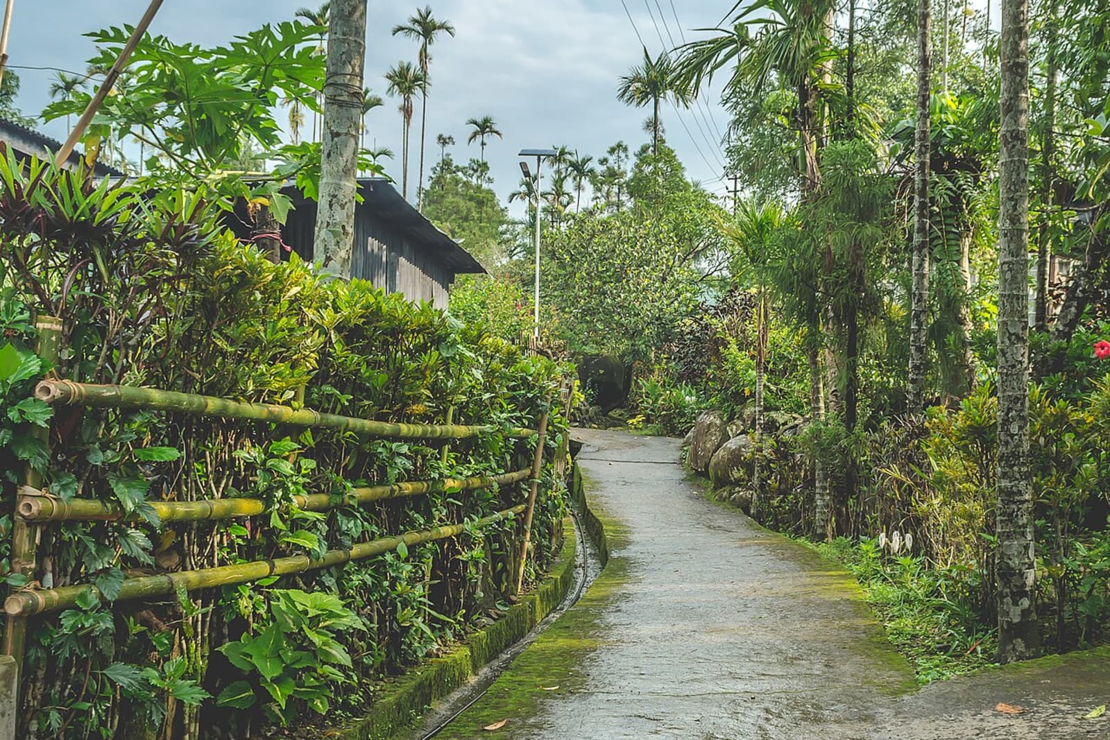
- Mawlynnong Village: Explore Asia's cleanest village, famed for its community-led conservation and rich Khasi culture.
- Boating in Umngot River, Dawki: Cruise on the glass-like waters of the Umngot River, bordering Bangladesh.
- Bamboo Trek in Mawryngkhang: Climb the legendary King of Stones along a handcrafted Khasi bamboo cliff path suspended over the Umrew River gorge.
- Eco Park: Panoramic Valley Views
- Double Decker Living Root Bridge: Bio-engineering Marvel
- Elephant Falls: Three-tiered cascade of Ka Kshaid Lai Pateng Khohsiew.
- Ward's Lake: A historic pine-ringed lake and botanical sanctuary in the heart of Shillong.
- Police Bazaar: Bustling City Hub
- Don Bosco Museum: A world-class anthropological journey through the tribal heritage of Northeast India.
- Shillong Golf Course: Gleneagles of the East.
- Cathedral of Mary Help of Christians: Explore the beauty of Cathedral of Mary Help of Christians in Shillong.
- Riwai Living Root Bridge: Living Botanical Architecture
- Krangsuri Falls: Explore the beauty of Krangsuri Falls in Jowai.
- Nartiang Monoliths: Explore the beauty of Nartiang Monoliths in Jowai.
- Nartiang Durga Temple: Explore the beauty of Nartiang Durga Temple in Jowai.
How Many Days in Meghalaya?
Plan your own route — or let us handle everything

Things to Do in Meghalaya
Curated experiences and activities across Meghalaya by local experts
Where to Stay in Meghalaya
Verified stays in Meghalaya with local character
Getting Around
Safe, reliable transfers and car hire in Meghalaya
Practical Travel Realities & Local Tips
Terrain, ground rules, and essential preparation for Meghalaya
Meghalaya offers diverse physical experiences ranging from wheelchair-accessible viewpoints to strenuous, vertical river gorge treks across the Khasi, Jaintia, and Garo Hills:
Trek Difficulty & Physical Metric Index
- Double Decker Living Root Bridge (Nongriat, Khasi Hills): Strenuous (Rating: 4/5). Requires descending and ascending 3,540 steep concrete stairs each way (7,080 stairs total) with a 720-meter vertical drop from Tyrna village, plus crossing two swaying steel-wire suspension bridges over river canyons. Knee Load: Severe eccentric quadriceps load. Rent a bamboo stick (₹20) at Tyrna for shock absorption. Staying overnight in a Nongriat homestay is strongly recommended rather than attempting a same-day 7,000-step round trip.
- Rainbow Falls Extension (Nongriat): Strenuous (Rating: 4.5/5). Located 1.5–2 hours (+2.5 hrs round trip) past the Double Decker bridge over natural boulders, unpaved tree-root stairs, and jungle streams. High cardiovascular endurance required; start before 8:30 AM from Nongriat.
- Wari Chora Emerald Canyon (South Garo Hills): Moderate (Rating: 3/5). A 3 km approach trek descending wooden ladders and boulder streams to the Rongdik River, followed by traditional bamboo rafting through 100ft vertical canyon crevices. Mandatory local guide and life jackets.
- Mawryngkhang Bamboo Skywalk (Wahkhen): Moderate-Hard (Rating: 3.5/5). A 3.5 km trail engineered by local villagers entirely out of bamboo and cane, cantilevered over 100-meter vertical river gorges. Extreme vertigo alert: Walking across 2–3 bamboo slats over deep ravines is not suitable for acrophobic travelers or during heavy rain when bamboo becomes slippery.
- Siju Bat Cave (“Dobakkol”, South Garo Hills): Moderate (Rating: 3/5). India's 3rd longest cave system (4.8 km). Involves wading through an active underground river (ankle-to-waist deep in winter) with headlamps among massive colonies of Dawn bats (Eonycteris spelaea).
- David Scott Trail (Mawphlang to Lad Mawphlang): Moderate (Rating: 2.5/5). A historic 16 km British-era horse trail through rolling pine hills, river valleys, and historic stone arch bridges. Low impact with a gentle net descent; requires 4.5 to 5.5 hours of continuous flat endurance walking.
- Wei Sawdong 3-Tier Falls: Moderate (Rating: 3/5). A short (~1.5 km RT) but intensely steep descent down tree roots and makeshift log ladders. Local guide is mandatory; swimming is strictly prohibited due to fatal underwater vortex currents.
Accessible Sightseeing for Senior Citizens & Families
Travelers with limited mobility or knee conditions can comfortably enjoy: Ward's Lake (100% flat paved pathways in central Shillong), Umiam Lake (panoramic viewing deck with ramps), Elephant Falls (Tier 1 view platform is step-free from parking ramp), Laitlum Canyons (flat grassy plateau directly by parking area), Pelga Falls in Tura (accessible viewing pavilions), and Eco Park Cherrapunji (paved pathways overlooking waterfalls and Bangladesh plains).
Local Culinary Traditions & Food
Authentic indigenous gastronomy, tribal flavours, and culinary culture in Meghalaya
Meghalayan gastronomy is an earthy, organic, meat-forward culinary tradition driven by wood-smoked meats, roasted black sesame paste, fermented soybeans, indigenous plant-ash alkali (Kalchi), and cooking inside green bamboo culms, without heavy commercial masalas or synthetic gravies.
Master Guide to Indigenous Khasi, Jaintia & Garo Dishes
- Jadoh (Khasi/Jaintia): The defining Meghalayan staple. Short-grain red hill rice (Ja heh) braised in a concentrated pork or chicken bone stock infused with crushed ginger, garlic, shallots, and black pepper. The celebratory version, Jadoh Snam, incorporates fresh blood for an intense, deep-red umami depth.
- Dohneiiong (Khasi/Jaintia): Tender pork belly slow-braised in a thick, nutty, pitch-black gravy made from roasted and crushed black sesame seeds (nei-iong) and green chilies.
- Wak Pura & Wak Gominda (Garo): Signature Garo pork delicacies. Wak Pura stews tender pork with finely ground rice powder (Pura), ginger, and Kalchi into a comforting, velvety gravy. Wak Gominda stews pork with sweet winter ash gourd with zero added cooking oil.
- Brenga (Garo Bamboo Roast): Marinated pork, country chicken, or river fish seasoned with wild mountain herbs and roasted directly inside fresh green bamboo culms over glowing wood charcoal with zero added water or oil.
- Minil Songa (Garo Bamboo Sticky Rice): Indigenous glutinous hill rice (Minil) steamed and roasted inside young bamboo shoots until wrapped in the fragrant inner bamboo membrane.
- Nakham Bitchi (Garo): A fiery, smoky, hot clear broth made from sun-dried and smoked river fish, crushed bird's eye chilies, fresh ginger, and Kalchi, served as an appetizing digestive starter.
- Tungrymbai (Khasi/Jaintia): Pungent fermented soybeans coarsely mashed and fried in mustard oil with pork fat, roasted black sesame, crushed ginger, garlic, and perilla seeds.
- Kalchi / Karchi (Garo Alkali Filtrate): Indigenous alkaline liquid filtered from the ash of burnt dry wild banana peels (Musa balbisiana). It replaces commercial salts and oils, tenderizes meat, and softens forest greens.
- Chubitchi & Chubok (Garo Rice Beer): Traditional sweet fermented rice liquor brewed using herbal yeast starter cakes (Wanti) infused with 15+ medicinal forest roots.
- GI-Tagged Lakadong Turmeric (Jaintia Hills): World-renowned indigenous turmeric containing 7.5% to 12% natural curcumin (compared to global averages of 2%–3%), imparting an intense golden hue and therapeutic properties to dishes.
- Kwai (The Social Ritual): Raw betel nut (kwai) wrapped in fresh betel leaf (tympew) with a dab of slaked lime (shun). Kwai is universally offered across all Khasi households as a gesture of equality and warm hospitality.
Curated Food Spots & Cafes
For authentic tribal cuisine, visit the rustic Dukan Ja stalls inside Iewduh (Bara Bazaar) like Trattoria and Kong Fertilis, or local Garo eateries in Tura market. For heritage dining and boutique cafe culture, visit Cafe Shillong in Laitumkhrah (famous for Khasi pork platters and live blues), Dylan's Cafe (Bob Dylan vinyls and waffles), and ML05 Cafe in Upper Shillong (wood-fired pizzas nestled in pine forests). Vegetarian and Jain safe-havens include City Hut Dhaba (Police Bazar), Jiva Veg Express (Nongpoh), and Madras Cafe (Jail Road).
Combine Meghalaya With
Extend your trip with nearby destinations
Travel Guides
Expert guides for Meghalaya
Reviews
"We got the best service than expected. The guide was very friendly and very very helpful, throughout our journey he guided us."
Ammiel Shabong
Shillong, Meghalaya
"Meghalaya is breathtaking. Nezo took us to the Double Decker Root Bridge, Dawki river, and Mawlynnong. Every detail was well planned."
Priya Sharma
Delhi, India
"The living root bridges of Meghalaya are a wonder. Nezo arranged a local Khasi guide who shared stories about the forests and traditions."
David Chen
Singapore
PLAN YOUR TRIP
FAQs
Can't find the answer you're looking for? Our expert travel team is always on hand to help you plan the perfect Meghalaya experience.
Ready to Explore Meghalaya?
Let our local experts help you plan the perfect trip. Get personalized recommendations and instant quotes.