
Dirang (Dirang Valley)
Updated 2026Temperate River Valley, 19th-Century Monpa Dzong & Alpine Black-Necked Crane Haven
| Category | Detail |
|---|---|
| Altitude / Elevation | 1,560 meters (5,118 ft) |
| Coordinates | 27.356° N, 92.239° E |
| District | West Kameng District |
| Historic Dzong | Dirang Dzong (Constructed 1831 CE) |
| Key Pass Mandala | Mandala Top (108 Stupas at ~3,000m) |
| Permit Mandate | ILP required for Indian citizens (eilp.arunachal.gov.in or arunachalilp.com); PAP for foreigners |
| Research Institute | ICAR National Research Centre on Yak (NRCY) |
| River | Dirang River (Kameng River tributary) |
| Wildlife Sanctuary Gateway | Sangti Valley (Winter habitat of Black-Necked Cranes) |
Dirang is a temperate river valley settlement situated at 1,560 meters (5,118 feet) in the West Kameng district of western Arunachal Pradesh. Serving as the primary acclimatization base on the road to Tawang, it preserves the 1831 Dirang Dzong fortress, ICAR's National Research Centre on Yak, geothermal sulphur springs, and the high-altitude Buddhist sanctuary of Mandala Top (108 Stupas).
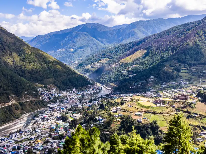
The rushing, turquoise currents of the Dirang River churn over smooth granite boulders, filling the sheltered valley with a steady, rhythmic roar. Crisp mountain breezes sweep through kiwi and apple orchards, carrying the faint mineral warmth of riverside hot springs and the distant chime of prayer wheels from Dirang Dzong. As evening descends, woodsmoke rises from stone Monpa homesteads against steep pine-clad slopes.
Inner Line Permit (ILP) is required for Indian nationals entering Arunachal Pradesh through Bhalukpong or Balemu checkposts (eilp.arunachal.gov.in or arunachalilp.com: fee ₹300 up to 3 days, ₹500 beyond 3 days up to 14 days). Foreign nationals must possess a valid Protected Area Permit (PAP, US$ 50).
Geography, Topography & Valley Microclimate
Dirang is a temperate mountain valley locality situated at an elevation of 1,560 meters (5,118 feet) above sea level in the West Kameng district of western Arunachal Pradesh. Positioned along the arterial Bhalukpong–Tawang highway corridor, Dirang lies 40 km north of the district headquarters at Bomdila and 135 km south of Tawang. The town occupies a flat alluvial basin carved by the swift-flowing Dirang River (also known as the Dirang Chu), a major tributary of the Kameng River within the greater Brahmaputra basin.
Surrounded by towering pine-forested ridges of the Lesser Himalayas that rise steeply to over 3,000 meters, Dirang enjoys a sheltered geographic setting that creates a mild, pleasant microclimate year-round. Unlike the harsh, sub-zero alpine conditions of Tawang or the fog-drenched heights of Bomdila, Dirang's valley floor remains protected from fierce northern winds. Summer temperatures range between 14°C and 26°C, while winter days are sunny and comfortable (10°C to 18°C), dropping to 2°C to 5°C at night.
The surrounding hills are cloaked in dense temperate broadleaf and coniferous forests dominated by Himalayan blue pine (Pinus wallichiana), oak, and alder trees. The fertile alluvial soil of the valley floor supports extensive terraced agriculture and commercial horticulture, making Dirang the primary fruit basket of western Arunachal Pradesh. Because of its moderate elevation, Dirang serves as the single most effective medical acclimatization base for travelers ascending to the high-altitude passes of Sela and Bum La.
Dirang Dzong (1831 CE) & Monpa Architectural Heritage
The historical and cultural centerpiece of the valley is Dirang Dzong, a fortified village and administrative fortress constructed in 1831 CE by the Monpa community. Functioning as both a military defensive bastion and an administrative seat under the historic Monyul governance system, the Dzong was strategically built on a rocky promontory overlooking the Dirang River to defend the valley against incursions from neighboring tribal groups and colonial patrols.
Constructed entirely of local river stone, timber beams, and mud mortar without modern iron reinforcements, Dirang Dzong showcases classic trans-Himalayan defensive vernacular architecture:
- The Fortress Architecture: The Dzong is a four-story stone structure with thick, sloping masonry walls designed to withstand regional seismic shocks and severe weather. Narrow, slit-like windows on the lower levels served as defensive arrow and musket loops (meurtrières), while upper wooden galleries provided living quarters for the village chieftain and visiting monastic authorities.
- The Living Village Settlement: Unlike many preserved historical fortresses that function solely as empty monuments, Dirang Dzong remains an active, inhabited Monpa village. Over 30 traditional stone-and-timber houses crowd the narrow, flagstone-paved lanes inside and around the fortress perimeter.
- Traditional Stone Houses: Houses feature ground floors constructed of river boulders used as cattle shelters and grain storage, with upper residential floors made of hand-hewn wooden planks and pitched tin or wooden-shingle roofs.
- Sacred Artifacts & Shrines: Within the Dzong complex sits a 500-year-old Buddhist prayer hall containing antique bronze butter lamps, ancient wooden prayer wheels, and historic wall paintings depicting the Gelugpa lineage.
During the 1962 Sino-Indian War, the Dzong briefly served as a military staging post and prison, and remnants of colonial-era holding cells can still be observed in the lower basements.
Key Sights: Hot Springs, NRC on Yak & Sangti Valley
Beyond its historical Dzong, Dirang encompasses unique scientific, geothermal, and ecological attractions:
- Natural Geothermal Sulphur Hot Springs: Located just 1 km from Dirang town along the banks of the Dirang River, these natural hot springs emerge from deep geothermal fissures in the crystalline bedrock. The water is rich in dissolved sulphur and other therapeutic minerals, maintaining a constant natural temperature between 38°C and 42°C. Concrete bathing pools have been constructed to allow locals and travelers to soak in the mineral-rich waters, renowned across the region for relieving joint pain, muscle fatigue, and dermatological ailments after long mountain journeys.
- ICAR National Research Centre on Yak (NRCY): Situated 2 km outside Dirang town with an experimental breeding farm at Nyukmadung (2,750 meters), this prestigious institution operated by the Indian Council of Agricultural Research (ICAR) is the premier yak research center in South Asia. Established to conserve and genetically improve the Indian Yak (Bos grunniens), the center conducts research on yak hybridization, frozen semen technology, high-altitude nutrition, and value-added yak products including refined Chhurpi cheese, yak wool apparel, and dietary supplements. Visitors can tour the research complex to learn about high-altitude pastoralism and observe experimental herds.
- Sangti Valley (Black-Necked Crane Winter Habitat): Located 12 km northeast of Dirang via a scenic winding river road, Sangti Valley is a flat, serene basin surrounded by pine-covered hills, kiwi orchards, and crystal-clear mountain streams. Between November and February, Sangti Valley serves as the critical wintering habitat for the rare and vulnerable Black-Necked Crane (Grus nigricollis), which migrates across the high Himalayas from the Tibetan Plateau. The local Monpas revere these sacred birds as celestial harbingers of good fortune and strictly protect their feeding grounds in the post-harvest paddy fields.
- Apple & Kiwi Orchards: The valley is carpeted with lush commercial orchards cultivated under state horticulture initiatives. During autumn (September–October), trees are laden with crisp Royal Delicious apples, golden persimmons, and fuzzy green kiwi fruits available fresh from roadside farm stalls.
Mandala Top (108 Stupas) & Buddhist Pilgrimage
Perched atop a commanding mountain ridge at an elevation of approximately 3,000 meters, Mandala Top (also known as the 108 Mani Stupas) is one of western Arunachal's most striking modern Buddhist pilgrimage sites, located 28 km from Dirang.
Built between 2014 and 2018 under the guidance of Buddhist spiritual leaders to promote world peace and environmental harmony, the sanctuary consists of 108 white Buddhist stupas (chortens) arranged in a precise, concentric mandala geometric formation along the perimeter of the mountain summit. Each stupa is inscribed with sacred Buddhist mantras and holds consecrated relics and scriptures.
The summit provides a sweeping 360-degree panoramic vista across the Eastern Himalayan ranges, offering unobstructed views of snow-capped peaks along the Bhutan border on clear mornings. Thousands of multi-colored prayer flags (lungta) string across the ridge, fluttering continuously in the high alpine winds. The mountain slopes surrounding Mandala Top are dense with oak and rhododendron forests that transform into a premier birdwatching destination during spring, harboring rare avian species including the Ward's Trogon, Blood Pheasant, and Fire-tailed Myzornis.
Local Monpa Food Culture & Agro-Horticulture
Dirang's food culture reflects the agricultural richness of its temperate valley floor combined with ancient highland Monpa culinary practices:
- Zan: A wholesome porridge made from roasted maize or buckwheat flour, prepared by stirring the flour into boiling water and simmering it with wild leafy greens, garden beans, and dried herbs.
- Gyapa Khazi: A traditional savory rice specialty made with local rice, fermented yak cheese (Chhurpi), diced mountain potatoes, ginger, and local green chilies.
- Momos & Thukpa: Freshly steamed dumplings stuffed with seasoned local pork, chicken, or organic cabbage and homemade cheese, paired with bowls of warm wheat noodle soup simmered with local herbs.
- Chhurpi Stew: A rich, pungent soup made from fermented yak cheese cubes cooked with dried red chilies, garlic, and wild mountain pepper.
- Fresh Organic Produce: Due to the valley's prolific orchards, local markets offer organic kiwi juice, wild honey, homemade apple jams, and fermented bamboo shoot pickles.
- Suja (Butter Tea): Churned black tea prepared with fresh butter and rock salt, served as an all-day hospitality drink in local homesteads and cafes.
Transit Logistics & The Strategic Tawang Stepping Stone
Dirang occupies an essential logistical position along the western Arunachal tourism circuit:
- Overland Access Route: Dirang is located directly along the main highway connecting Tezpur/Guwahati to Tawang. From Guwahati (320 km / 7–9 hours) or Tezpur (175 km / 4–5 hours), vehicles travel through the Bhalukpong checkpost, pass Tipi and Rupa, ascend to Bomdila (2,217m), and descend into the Dirang basin (1,560m).
- The Ideal Acclimatization Hub: While Bomdila sits at a colder, higher elevation of 2,217 meters, Dirang's altitude of 1,560 meters provides the perfect transitional staging ground. Spending an overnight stop in Dirang allows travelers to acclimatize comfortably, enjoy deep sleep without altitude headaches, and prepare their bodies before the steep ascent through the Sela Tunnel (3,960m) into Tawang (3,048m) the following day.
- Onward Transit to Tawang: From Dirang, the journey to Tawang spans 135 km (4.5 to 5.5 hours), climbing steadily past Nyukmadung and the Sela Tunnel before descending through Jang into Tawang town.
Practical Travel Guide (The Honest Guide)
A trip to Dirang is straightforward but requires adherence to regional travel protocols:
- Permit Mandates (ILP & PAP): Domestic Indian citizens must possess a valid Inner Line Permit (ILP) obtained via
eilp.arunachal.gov.inorarunachalilp.com(fee: ₹300 up to 3 days, ₹500 beyond 3 days up to 14 days). Ensure physical hard copies are readily available for presentation at the Bhalukpong border checkpost. Foreign visitors require a Protected Area Permit (PAP, US$ 50) obtained through authorized travel agents for groups of two or more. - Road Conditions & Vehicle Selection: The highway from Bhalukpong to Dirang is well-paved with double-lane sections and modern bypass tunnels (Nechiphu Tunnel). Standard sedans can navigate the main highway to Dirang, but high-ground-clearance vehicles (SUVs) are recommended if you plan excursions up the unpaved winding road to Mandala Top or Sangti Valley.
- Banking & Connectivity: Dirang town has operational State Bank of India (SBI) and regional bank ATMs along the main market road. UPI digital payments work reliably in local hotels and larger shops, but carrying ₹3,000 to ₹5,000 in cash is advisable for rural homestays and orchard farm stands. Airtel, Jio, and BSNL provide stable 4G data coverage throughout the main valley.
Dirang is part of the breathtaking Northeast India region, known for its pristine natural beauty, rich tribal culture, and unique biodiversity.
TRAVEL PLANNING
Plan Your Visit
Essential guides to prepare for your trip
Itineraries & Trips
Curated 3-day, 5-day & 7-day trip routes
Places to Visit
Top waterfalls, viewpoints & landmarks
Best Time to Visit
When to go for the best experience
How to Reach
Flights, trains, taxis and road options
Where to Stay
Homestays, eco-lodges & resorts
Permits & Entry
Required documents and ILP pass guidance
Dirang Tour Packages
Ready-to-book Dirang tours


Need a Custom Plan?
As Northeast India locals, we work directly with our trusted community drivers and homestay hosts.
Talk to an ExpertTOP ATTRACTIONS
Places to Visit in Dirang
Must-see attractions and hidden gems across Dirang


- Dirang Monastery: Place of Flourishing of the Buddha’s Speech overlooking the scenic Dirang valley
- Nechiphu La: Strategic mountain pass and state-of-the-art tunnel gateway of West Kameng
- Chug Valley: Thousand-Year Handmade Paper, Autumn Cosmos Blooms & Living Monpa Heritage
- Sangti Valley: The winter home of the Black-necked crane in the Eastern Himalayan foothills
- Mandala Top: The Sacred Summit of 108 Stupas and High-Altitude Birding in Dirang
How Many Days in Dirang?
Plan your own route — or let us handle everything
Things to Do in Dirang
Curated experiences and activities across Dirang by local experts
Where to Stay in Dirang
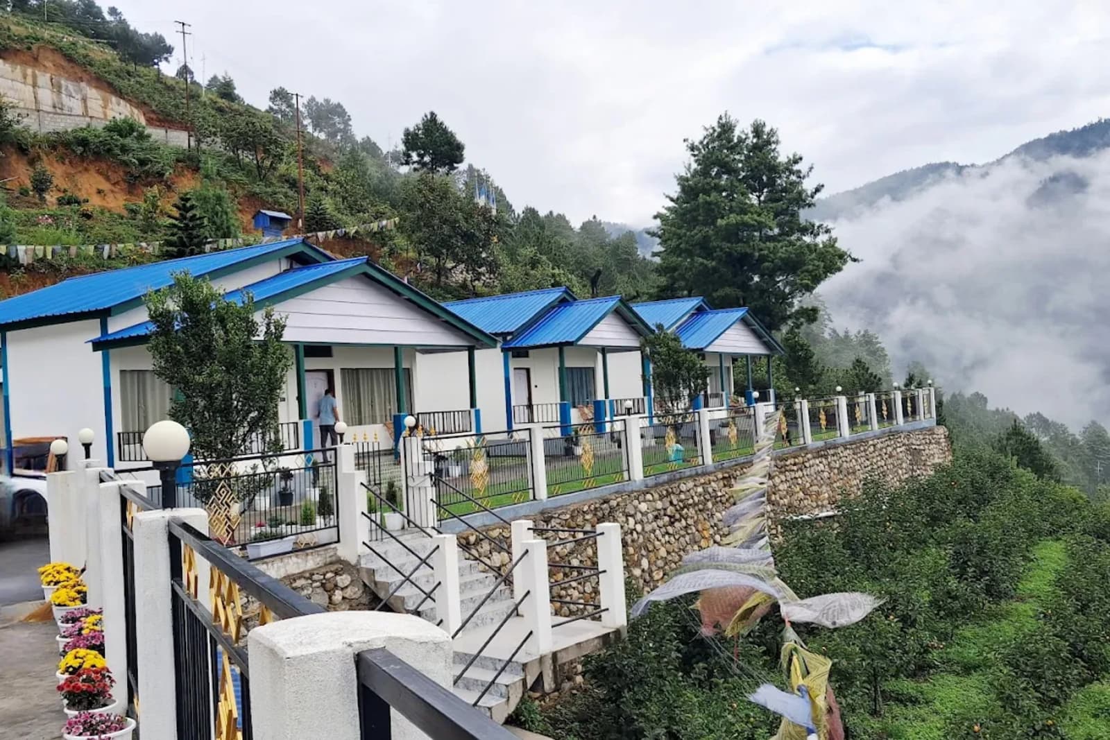
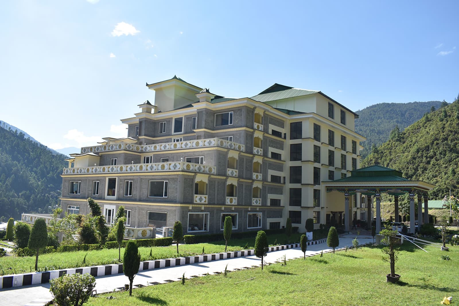
Verified stays in Dirang with local character



Getting Around
Safe, reliable transfers and car hire in Dirang
Practical Travel Realities & Local Tips
Terrain, ground rules, and essential preparation for Dirang
Dirang is rated an Easy to Moderate destination, serving as the essential acclimatization buffer on the Tawang circuit:
- Altitude & Acclimatization: Dirang sits at 1,560 meters (5,118 ft) in an oxygen-rich valley. Staying 1–2 nights here stimulates red blood cell production and prevents Acute Mountain Sickness (AMS) before ascending to Sela Tunnel (3,962 m) and Tawang (3,048 m).
- Walking & Terrain: Exploring Dirang Dzong involves navigating historic flagstone staircases and cobblestone alleyways. Visiting Thupsung Dhargye Ling and Sangti Valley requires gentle walking over paved paths and riverbank meadows.
- Mandala Top Excursion: Reaching Mandala Top (3,050 m) involves a 28 km uphill drive with steep switchbacks. Walking the concentric 108 stupas ring is an easy, paved circular stroll at higher altitude.
Local Culinary Traditions & Food
Authentic indigenous gastronomy, tribal flavours, and culinary culture in Dirang
The traditional food culture of Dirang is defined by organic Himalayan agriculture, high-altitude Monpa pastoral traditions, and Tibetan culinary influences. Meals emphasize wholesome steaming, boiling, and natural fermentation without heavy commercial spices or artificial additives:
- Zan: The quintessential Monpa comfort staple—a smooth, slow-simmered porridge made from roasted finger millet, buckwheat, or barley flour, eaten hot with seasoned forest greens, dried meats, or fiery cheese gravies.
- Thukpa & Momos: Steaming bowls of hand-pulled wheat noodles simmered in aromatic herbal bone or vegetable broths, accompanied by delicate steamed dumplings filled with spiced meats or local cheese and mountain cabbage.
- Churpi & Chamin: Fermented yak milk cheese. Soft churpi is stewed with roasted bird's-eye chilies into Chamin, a pungent warming table condiment; hard smoked churpi cubes serve as long-lasting trail snacks.
- Khura & Po Cha: Crisp buckwheat savory pancakes paired with salty, churned yak butter tea (Po Cha / Suja) that restores electrolytes and prevents chapped lips in mountain weather.
- Organic Valley Produce: Freshly harvested organic kiwifruits, crisp red apples, persimmons, and small-batch artisanal fruit wines from Sangti Valley.
Combine Dirang With
Extend your trip with nearby destinations
Travel Guides
Expert guides for Dirang
Reviews
"Nezo Tours organized our fantastic trip. The team was attentive and flexible, accommodating last-minute changes to suit our needs."
Yamini Peter
Mumbai, Maharashtra
"We got the best service than expected. The guide was very friendly and very very helpful, throughout our journey he guided us."
Ammiel Shabong
Shillong, Meghalaya
"Service was excellent. Prices were the best compared to those offered by others. All in all a satisfying experience. Definitely recommended."
Pradeep Agarwal
Delhi, India
PLAN YOUR TRIP
FAQs
Can't find the answer you're looking for? Our expert travel team is always on hand to help you plan the perfect Dirang experience.
Ready to Explore Dirang?
Let our local experts help you plan the perfect trip. Get personalized recommendations and instant quotes.